Vehicle tracking
NavCenter WEB
NavCenter WEB service is an easy to use vehicle tracking and route recorder system. With the support of this service, you can monitor on a map interface the motion of your car or company vehicles. You can create detailed daily route records and complete the monthly mileage accounting, and also analyze on spectacular charts motion and speed of the vehicles.
Please watch our promotional video (full screen mode recommended)!
NavCenter web customers are also able to use our smartphone applications.
Login
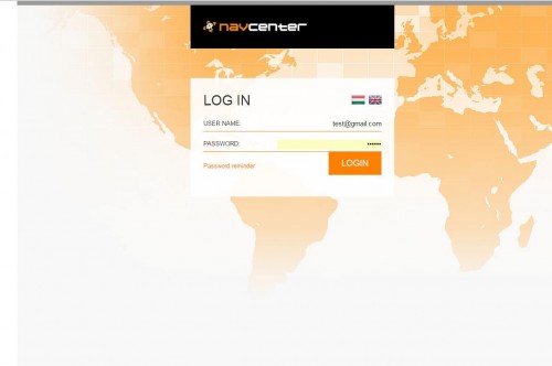
Login at smartcar.navcenter.hu website by your customer credentials.
Tracking
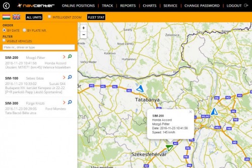
After the login, in the “Tracking” menu you can display on the map all your vehicles. The map will zoom to a level at which the view will frame all the actual vehicle positions. The table on the left contains descriptive data and location parameters of the vehicles. The vehicle with the most up-to-date location will be the first in the list. The data are updated automatically every minute.
The view can be zoomed to a selected vehicle. You can zoom in and out on the map and drag the map as preferred.
Route
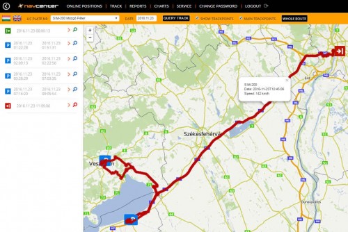
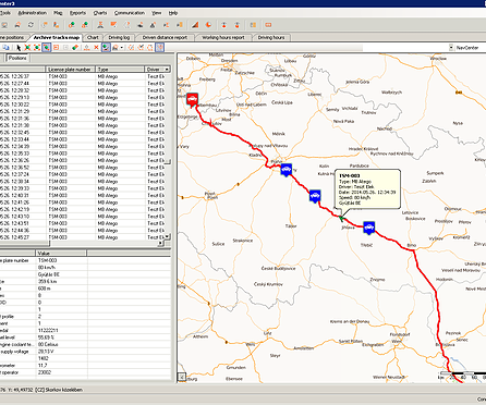
In the “Route” menu, previous routes of the vehicles can be visualized on the map. Select a vehicle from the drop-down window and set the required date. The route of the vehicle for the entire day will appear on the map. You can study details of the route in the table on the left: departure and arrival times, location and timing of the stops, segments of the route and the whole length of the route. By clicking on the stops in the list, the map will zoom to the location of the selected stop, and all the related details will be shown in a close view.
By clicking on a point of the route on the map, the speed and time will be displayed, as well as the length of the route section up to the selected point.
Report
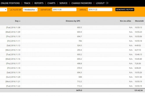
The third menu provides tools for reporting on previous routes of the vehicles. The detailed report is called route sheet. Select a vehicle and set the first and the last days of the period to be included in the report. In the table displayed, you can then see the departure and arrival times, segment lengths, waiting times and exact location of the stops. In the last row of the table, the length of the complete daily route will be displayed. The data can be exported in four different file formats and saved to your computer.
Should you prefer to query the mileage only (e.g. for a monthly accounting) with no detailed information within the one day periods, you can select the “km summary” option. This table will only display the mileage per day and the sum of the kilometers run within the entire period queried. This table can also be exported and saved in different formats.
Charts
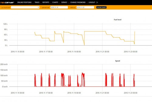
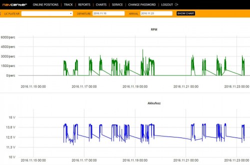
The “Charts” menu supports the transparent and simple analysis of the motion of vehicles. From the speed-time chart, excessive speed values and the time of possible over speeding events can be read. The distance-time chart allows you to analyze time periods spent in motion and waiting times.
NavCenter is a GPS-GSM based vehicle tracking system. With its support, you can monitor from your office the motion of your vehicle-fleet – even it being located all over Europe.
NavCenter PRO
NavCenter is a GPS-GSM based vehicle tracking system. With its support, you can monitor from your office the motion of your vehicle-fleet – even it being located all over Europe.
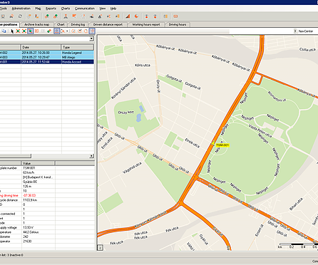
The system is based on a locator and tracking GPS device installed inside the vehicle. Through the SIM card of the device, data will be transmitted to the dispatcher software, this providing the user on a remote location with a real-time view on the vehicle-fleet of the company.
You can share with your clients the possibility to monitor the vehicles, so they can follow the route of the trucks carrying their goods. Based on the data, the dispatcher software supports compilation of route sheets, monthly mileage accounting and creation of charts, efficiently decreasing the time consuming administration in the office. In addition, it also supports the storage of vehicle tracks and subsequent analysis of these.
Online position
By selecting a vehicle, its currenct positions with its arguments can be shown on the map. Arguments contain vehicle speed, heading, ignition state and state of various analogue and digit sensors.
Direct connection
The system ensures continuous GPRS communication between the dispatch center and the vehicles.
Important working data
NavCenter records all the important information, it can even send instant messages about these. You could be notified on the exact time of the opening of the cargo compartment.
Query route details
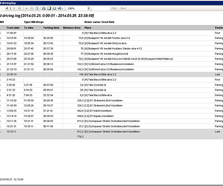
Driving time statistics
For international carriers, compliance with the required rest times provided by the law is very important. NavCenter supports the creation of relevant reports.
Simplified administration
Several features of NavCenter support the compilation of mandatory reports. Based on the data, route sheets can be printed, monthly mileage accounting, reports on operating times, driving times prescribed for carriers can be created.
Charts
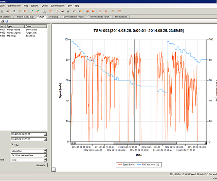
Impressive charts can be produced from the stored data. The change of the fuel level of a vehicle can be analyzed, speed-time or distance-time charts can be created. The data can be exported to Excel format and processed in other systems as well.
Driver identification
A quick and low-cost solution is provided by the iButton driver identification keys for cases of more drivers using the same vehicle.
Sensors
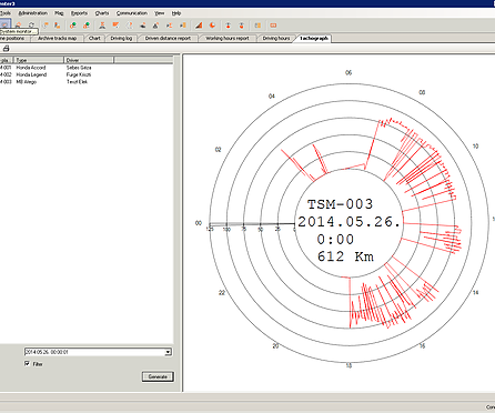
It is also possible to monitor the status of sensors in the vehicle and notify the dispatcher of status changes. E.g. the system immediately notifies the dispatcher when the discharge valve of a tanker is open. In case no instant notification required, the device will only store the event, and this will be included in the route sheet later.
Another possibility is to measure analogue values, such as fuel level or cargo compartment temperature changes. These data are continuously registered by the on-board unit, and diagrams will be created later by the software based on these data.


